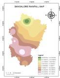
In this session you will learn about various online sources of data downloading and a exporting a High Resolution Map with all required details as needed in Research papers or Thesis for Masters and PhD students. Exporting high-resolution maps in ArcGIS can be crucial for creating quality prints, reports, or sharing detailed visualizations. Here are steps to export that will be discussed in details:
Layout View Export (Set Map Properties, Prepare Layout, Adjust Layout, Export Layout), Data Frame Export ( Prepare Map View, Set Data Frame Properties, Export Map), Resolution Settings, File Formats, Page Size, Vector PDF.
When presenting maps in professional settings, such as board meetings or conferences, high-resolution exports enhance the overall visual appeal and professionalism of your presentation materials. If you are creating maps for publication in journals, articles, or other documentation, high-resolution exports meet the standards for quality and readability. This is particularly important in academic and research contexts.


